Lewis and Clark (Virtual) Ride: Camp Dubois to St. Charles
In 1803, President Thomas Jefferson tasked Meriwether Lewis, William Clark, and their Corps of Discovery to find “the most direct & practicable water communication across this continent.” On May 14, 1804, the explorers shoved off for their first leg of what would become one of the greatest stories in American history – a nearly 4,000-mile journey through the immense wilderness of the Louisiana Purchase to the Pacific Ocean and back. To learn more about their expedition and our nation’s history, I will be (virtually) following Lewis and Clark’s route – as closely as modern roads allow – on my PRO FORM Le Tour de France stationary bike. As I come across interesting locations and historic events, I will share them here.
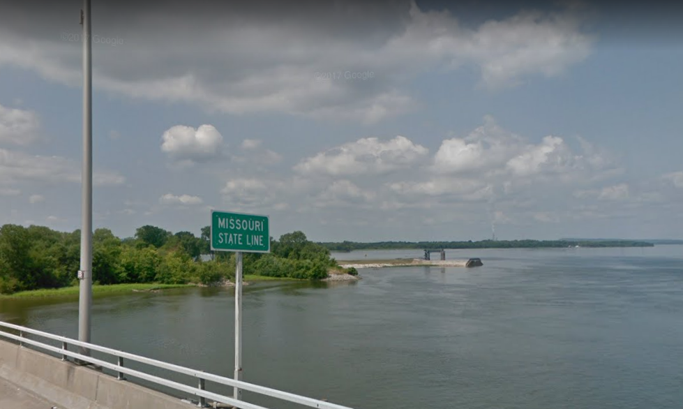
My first leg starts out just north of what was (in Lewis and Clark’s day) the unincorporated settlement of St. Louis. At the time, St. Louis was a mere four decades old and also went by the name Pain Court, which was French for “without bread,” as the remote fur trading settlement’s lack of proximity to agriculture meant bread was often scarce. Just a few miles upstream, near modern-day Alton, Ill., the Corps of Discovery spent the winter of 1803-4 at Camp Dubois, which overlooked the confluence of the Missouri and Mississippi Rivers.
The original site of Dubois (then part of Indiana Territory) was lost to the migrating Mississippi riverbed, so I begin my virtual ride in modern-day Wood River, Illinois. On a rainy May 14, 214 years ago, a shot from the keelboat’s “swivel gun” marked the beginning of the journey as Lewis and his men shoved off from the riverbank. In two days they rendezvous with Capt. Lewis at St. Charles, who had been wrapping up last-minute business in St. Louis.
While I am unencumbered by tons of gear and don’t have to fight river currents or concern myself with ambushes, my rides are limited to when I can find the time, so I will roughly be keeping pace with the Corps of Discovery, who put in somewhere between 10 and 15 miles per day on average.
Due to time constraints, the 32-mile trip from Dubois to St. Charles took me two days. I ended Day One’s ride just south of the town of Portage Des Sioux, which was established in 1799 by the Spanish government in response to rumor that the Americans would build a fort 12 miles downstream near Alton. The way the world used to work was that your empire was only as large as your ability to project your power, and states were continually expanding and contracting based – or disappearing altogether – based on their strength. The French laid claim to the territory in 1699, then ceded it to Spain in 1762. Hoping to rebuild the French empire, Napoleon acquired the area in 1800, but with war looming with Britain, turned around and sold Louisiana Territory to the United States, expanding our western border from the Mississippi River to the Rocky Mountains for just $15 million – roughly three cents per acre.
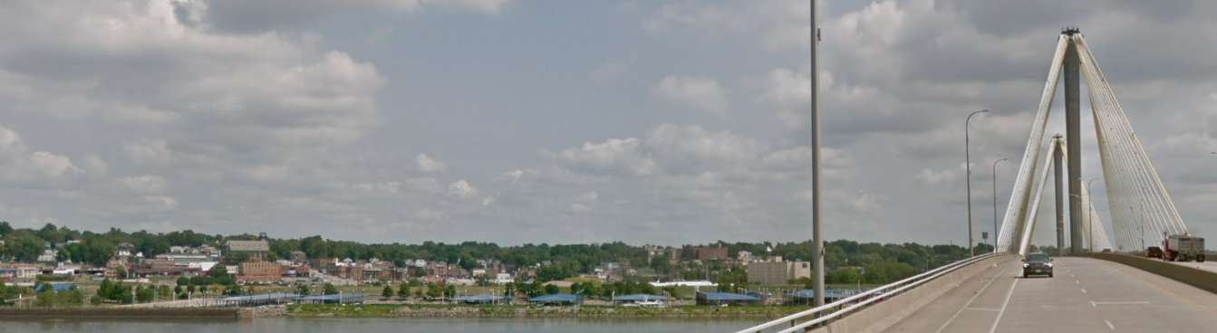
The second leg took me through 17 miles of pool-table flat farmland between the Mississippi and Missouri Rivers before cruising into St. Charles, one of the oldest European settlements west of the Mississippi. Founded by French Canadians in 1769, the site was originally called Les Petites Côtes (the little hills), before being renamed San Carlos del Misuri (Saint Charles of the Missouri) by the Spanish. In 1821, just 15 years after Lewis and Clark returned from their journey, St. Charles becomes home to Missouri’s first state capitol, occupying the upper story of a hardware store.
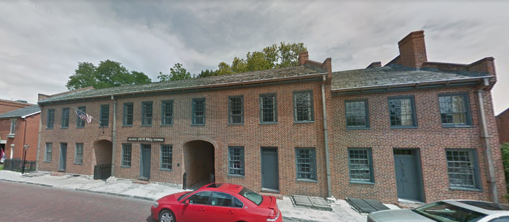
Somehow, the Governor, House of Representatives, and Senate managed to cram into this relatively small space and conduct their state business for five years until the new capitol building was finished in the “City of Jefferson” in 1826. It took the Corps of Discovery ten days to cover 114 miles to the confluence of the Missouri and Osage rivers, near the site of modern-day Jefferson City.
With Fort Clatsop, Ore. being some 3,700 miles away from my starting point, I now have roughly 3,668 miles to go.
Click here for later posts of my virtual ride along the Lewis and Clark expedition route.