Civil War map illustrates how much transportation has changed
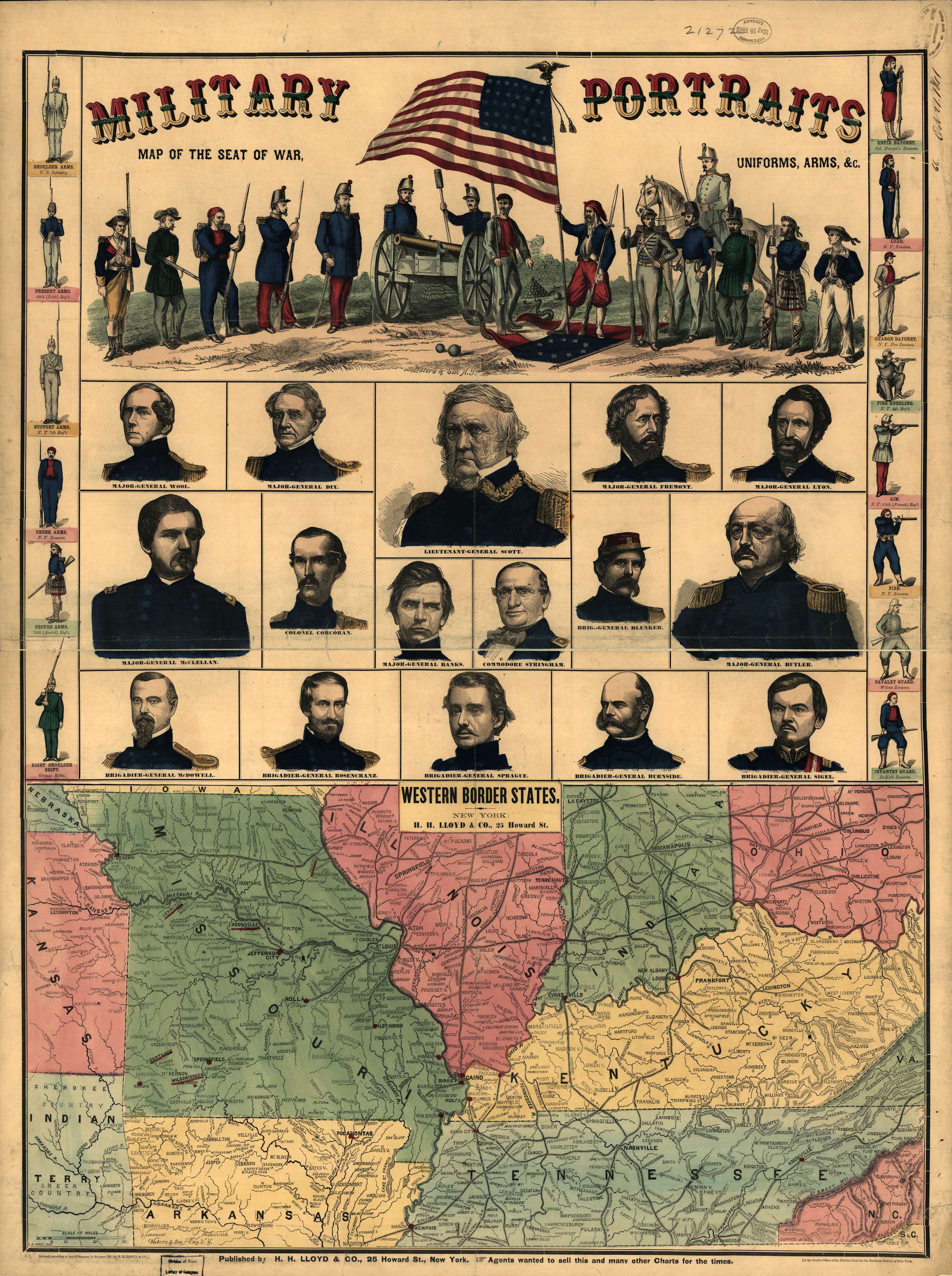
This map gives an interesting perspective in that you can see how different of a world we live in compared to that of 1861. Railroads were a relatively new form of transportation, covering just over 30,000 miles of track in 1860. The Hannibal and St. Joseph Railroad marked the western limit of railways prior to the Transcontinental Railroad, which wouldn’t be completed until after the Civil War. In those days, people moved products on waterways, and proximity to rivers or coastlines determined the size of a city. For example, at the time this map was drawn, St. Joseph, Mo. (along the Missouri River) and Hannibal, Mo. (on the Mississippi River) were the second- and third-largest cities in the state, respectively. While St. Joseph has slipped to ninth, Hannibal is now 41st in size as America expanded, new modes of transportation changed our economy, and our way of life adapted.
Major rivers were important for shipping and travel, as long as you were on the river. Crossing rivers would remain an obstacle for years.
The Mississippi, for example, wasn’t bridged until the Rock Island Bridge connected Rock Island, Ill. and Davenport, Iowa in 1856. Interestingly, a lawyer named Abraham Lincoln represented the bridge builders, whose project was opposed by the steamboat industry. Secretary of War Jefferson Davis also actively opposed the bridge’s location, preferring a southern route. The site of the bridge was determined based on an 1837 topographic study by Lt. Robert E. Lee. There wasn’t a bridge across the Mississippi south of the confluence with the Missouri until 1874 when the Eads Bridge opened in St. Louis, Mo.. The Eads Bridge (which I have used many times) was the world’s first steel bridge and remains in use today.
Our economy relies on roads as much as we rely on oxygen. But in 1861, roads weren’t even important enough to draw on this map. President Thomas Jefferson commissioned a national road — the Cumberland Road — less than 50 years ago, ultimately stretching from Cumberland, Va. to Vandalia, Ill..
Nearly 160 years later, at least where I live along the Mississippi, rivers are still a great way to move a lot of goods. We still maintain some 90,000 miles of railroads, but they are no longer vital to the degree they were in 1861. Aircraft are useful in some applications barges move rivers remain vital to transporting goods, at least on the Mississippi where I live. Regardless of what is being shipped, it all has to be driven by a truck on a road at some point. Roads back then were primitive compared to the vast network of millions of miles of interstates, U.S. and state highways, county and city roads we take for granted today.
If only there was a way to see what people 159 years from now would say about us.